
Nokogiriyama
Researched and written by Hinato
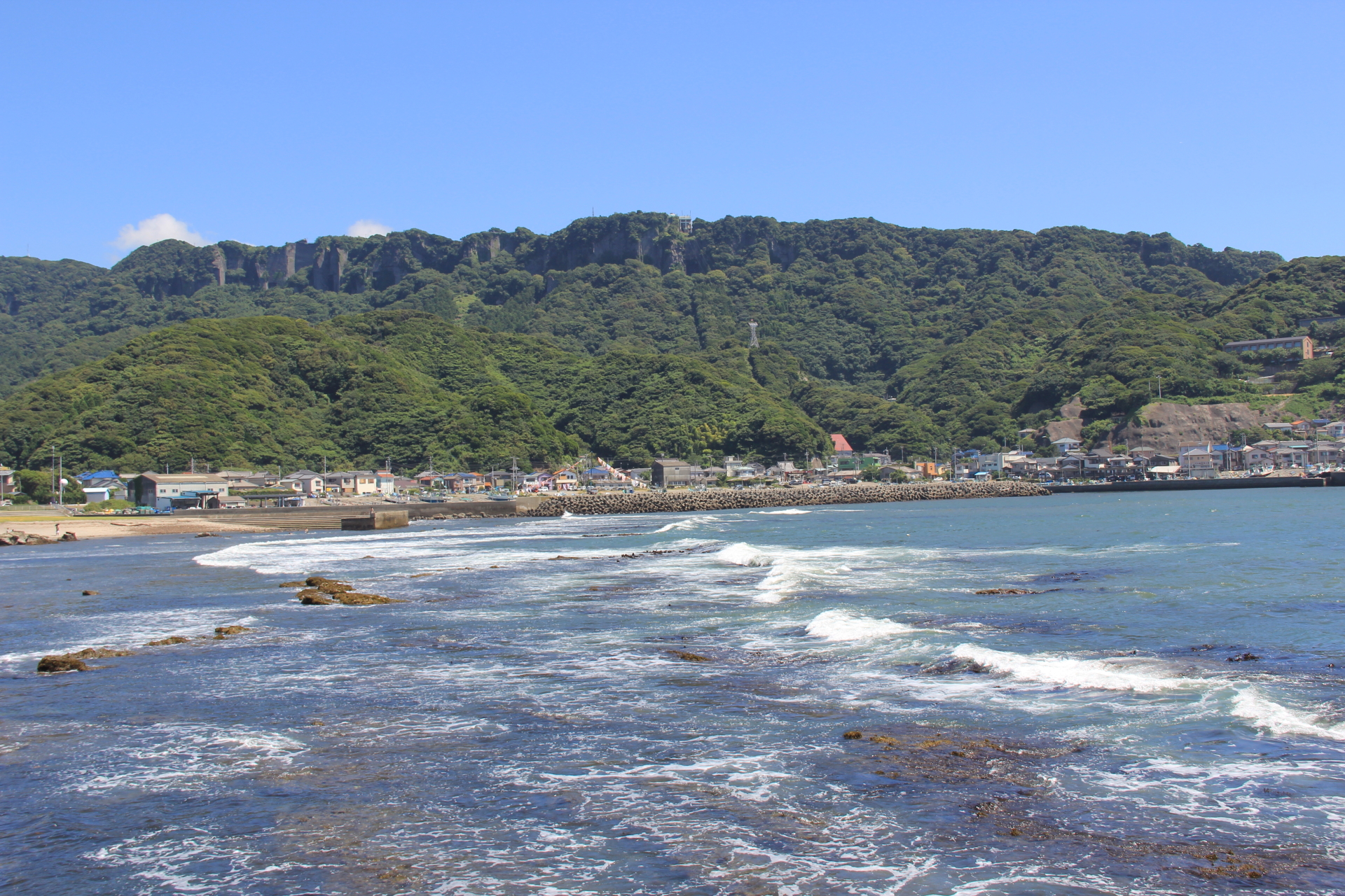
Photo: certified / Wikimedia Commons (CC BY 3.0) · original
Step through the gate at Nokogiriyama and the first thing you notice isn't the architecture — it's the quiet.
Nokogiriyama (鋸山, 'Saw Mountain,' 329m) earned its name from the jagged cliff face created by 300 years of stone quarrying. The mountain supplied stone for Edo (Tokyo) construction during the Tokogawa period, leaving dramatic vertical cuts and viewing platforms that jut over sheer drops. The summit area contains Nihon-ji Temple, home to a 31-meter-tall carved Buddha — the largest pre-modern stone Buddha in Japan.
The mountain offers three ways up: ropeway, hiking trail (45-60 minutes), or the 'Jigoku Nozoki' (Hell's Peek) cliff trail that requires scrambling over exposed rock with chain assists. The views from the cliff platforms extend across Tokyo Bay to Mt. Fuji on clear days — a reward that feels disproportionate to the mountain's modest elevation.
Plan your visit
Time to allow
3-4 hours (ropeway + Daibutsu + Jigoku Nozoki + Kannon trail)
Hours
9:00 AM – 5:00 PM | Hiking trail accessible from dawn
Closed: Open year-round
Admission
Ropeway: ¥1,200 round-trip | Nihon-ji Temple: ¥700 | Hiking trail: Free
Best season
Autumn (October) for hawk migration and clear Tokyo Bay views | Spring for cherry blossoms | Winter mornings for Mt. Fuji views
Getting there
Access notes
What locals know
Nearby Spots
The closest hidden gems to Nokogiriyama, by straight-line distance.
 Illustration — not a photograph
Okamoto Pier
Little knownA wooden pier about 160 metres long, built in 1921 to land fish and out of that use since 1961, running straight out fro…
 Tetsuji Sakakibara / CC BY-SA 2.0
Oyama Senmaida
Little knownThree hundred and seventy-five rice paddies stacked up a steep slope over 3.2 hectares, the closest terraced rice landsc…
 veroyama from Meguro, Japan / CC BY-SA 2.0
Futtsu Cape Observation Tower
Little knownFuttsu is a sand spit that runs five kilometres out into Tokyo Bay, narrowing to almost nothing, and at the very end of…
Okinoshima Island
Little knownOkinoshima is a small island connected to the Tateyama coast by a 500-meter sandbar, creating a tide-dependent land brid…
Taibusa Cape
Little knownTaibusa Cape (太房岬) forms the southernmost tip of the Boso Peninsula, where the Pacific Ocean meets Uraga Channel. The su…
Tateyama Flower Fields
Little knownTateyama's temperate coastal climate — moderated by the Kuroshio Current — creates the 'Flower Highway,' a 50km stretch…
More in Chiba
Boso Peninsula Railway Crossing
Little knownTwo small railways meet end to end at a station in the middle of nowhere and, between them, cross the Boso peninsula. Th…
 Illustration — not a photograph
National Museum of Japanese History
Little knownThis is the national museum for the history of Japan, and it is not in Tokyo — it is on the grounds of the old Sakura ca…
 Illustration — not a photograph
Sakura Samurai Houses
Little knownSakura was a castle town of the Hotta clan, close enough to Edo that its domain school and its samurai mattered, and thr…